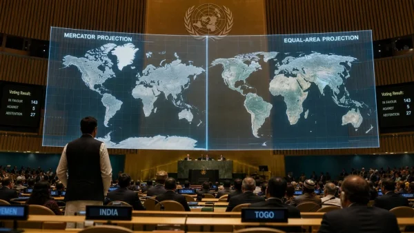
In backing the UNGA’s drive to put the world on paper in a new way, India found itself at odds with the United States, which was the only country to resist. New Delhi has been urging for cartographic neutrality and support for equal-area approaches to put right the visual downplaying of Africa, Latin America and South Asia that has gone on for decades.
The nonbinding resolution, known as Correct the Map, was adopted on Friday and represents a turn from the 16th-century Mercator to models that keep relative landmass size intact. Its purpose is to steer official materials, the media, digital platforms and schools toward a truer view of the world.
What changed at the UNGA
The Togo-sponsored measure put before the 193-member assembly won 164 votes. The US was the lone dissenter; Estonia, Georgia, Lithuania, Moldova, Serbia and Ukraine chose to abstain.
According to the text, the Mercator may still be the go-to for navigation but it has a habit of inflating areas close to the poles and shrinking those by the equator. The resolution is concerned that such distortion gives an unbalanced picture of the world.
Here is how the vote broke down:
– Vote outcome: 164 in favour, 1 against
– Abstentions: Estonia, Georgia, Lithuania, Moldova, Serbia, Ukraine
– Sponsor: Togo
– Status: Nonbinding guidance
India’s support, with a neutrality clause
Raghoo Puri, First Secretary at India’s Permanent Mission to the UN, made the case for India in his explanation of vote. He said the country welcomes any move to have maps that are representative and accurate, given the role they play in how society understands geography and scale.
But there is a line to be drawn, according to New Delhi. Puri was at pains to point out the resolution is in support of wider use of equal-area projections and should not be taken as an endorsement of the Equal Earth or any one system.
Equal-area without picking winners
India has called for the measure to be neutral in method and technology so that cartographers and institutions can pick what suits them. In India’s view, encouraging equal-area where one wants to show the true size of continents fulfils the resolution’s intent without giving preference to a single methodology.
Why the Mercator debate matters
There is a price to pay for the directional accuracy Mercator affords the navigator. Equatorial regions are minimised while landmasses near the poles are made to look much bigger than they are.
Take Greenland and Africa: on a Mercator they are roughly the same size. In fact Africa is some 14 times larger. Africa is about 30.37 million square kilometres to Greenland’s 2.16 million.
Then there is Alaska and Brazil. They seem comparable on the map yet Brazil is nearly five times the size of Alaska (8.5 million versus 1.7 million square kilometres). Antarctica’s expanse is no less exaggerated.
US dissent and Togos defence
Washington sees the change as part of a radical ideological project and an affront to the UN’s work. After all, the US, Russia and Canada are diminished in equal-area views compared to the Mercator.
Togo’s Foreign Minister Robert Dussey has stood up for the resolution, insisting it does not seek to impose a projection or condemn the Mercator. ‘A fair map does not change the geography of the world, it changes how we see the world,’ he was quoted as saying in a UN handout.
What comes next
With the UNGA putting forward equal-area options like the Equal Earth as a way to correct scale bias, the resolution is meant to promote better cartography in education and the media.
India's vote in favour, tempered by its caveat on neutrality, is a pragmatic stance. All eyes will be on whether the guidance is followed by institutions and if a more equitable map can alter the perception of places like South Asia, Latin America and Africa.