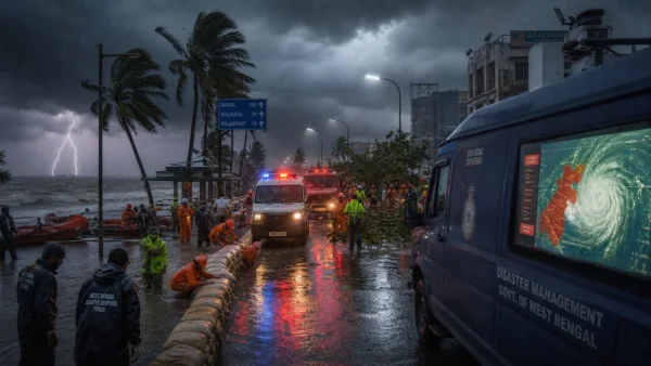
The IMD has been forced to put a red alert on parts of West Bengal as this fast-moving system in the Bay of Bengal is set to bring downpour over the weekend. As the low-pressure area makes its way to becoming a deep depression, officials have gone into 24×7 mode.
Where the threat is highest
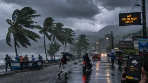
It is South 24 Parganas and Purba Medinipur that have the IMD’s top-tier red warning. An orange alert has been put on Jhargram, Paschim Medinipur and Howrah, with the agency telling those in those districts to be prepared for some rough weather and the chance it could get worse.
There is a warning from the agency that things may not improve by Sunday. Should the system deepen as they think it will, one can expect extremely heavy rain in South 24 Parganas, the two Medinipurs, Jhargram, Purulia and Bankura.
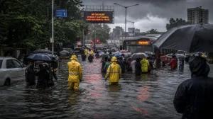
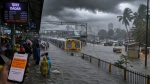
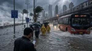
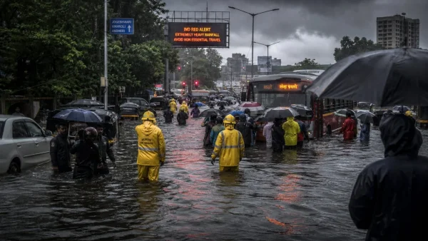
Kolkata and its surrounds are on an orange watch. The forecast has heavy rain, some thunder and winds up to 50-60 kmph in spots. Skies were already overcast in the city on Saturday, July 4, 2026, as the change in weather set in.
What IMD says about the system
Those at the IMD see the low-pressure area hardening into a deep depression before it comes in on the West Bengal-Odisha coast. That path means there is a good chance of steady, hard rain for the rest of the weekend.
South Bengal is in for a lot of rain in the days ahead. The most probable outcome, according to the IMD, is isolated but heavy to extremely heavy rain, accompanied by squalls and storms.
How the state is preparing
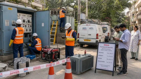
You will find the state has put its emergency protocols to work in the more exposed areas. Districts have been instructed to be on hand for any rain-induced problems, with a particular eye on the low-lying ground.
Control rooms are open all hours and teams are in position. From disaster management to civil defence, the personnel and gear are on standby to deal with whatever the downpour might throw at them.
The message from officials is to act fast when it comes to waterlogging or a tree coming down. The idea is to see to it that essential services don’t falter and to put things right in a hurry if the infrastructure takes a hit.
Some of the moves the administration has made are:
– A watch on the more vulnerable, low-lying zones
– Having rapid deployment teams ready to go
– Dealing with water and fallen trees as they happen
Why this matters now
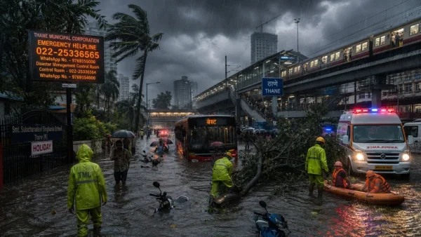
The red alert is a sign of the flood and disruption danger in the coastal and riverine tracts. As the system gains power, it is possible for bands of rain to run over the same ground, which is a recipe for urban flooding and a loss of power.
Those in the orange zone would do well to be ready. Even if one is not in the red, the IMD sees the prospect of some hard rain and wind in the offing for the next few days.
What to expect next
Provided the low-pressure area does what is predicted, the rain is likely to pick up on Sunday. The IMD has put out a heads-up that multiple south Bengal districts could be in for it as the system comes ashore.
The rest of the districts in the south are in for their share of it as well. In Kolkata, the mix of storm, squall and 50-60 kmph winds may put a strain on the drains and lead to some standing water in the odd spot.
Both the administration and the IMD will have more to say as events unfold. It is best to follow the official line and be in the mind of there being some travel hold-ups, a road here or there being shut, or a short break in the power during the heaviest of it.