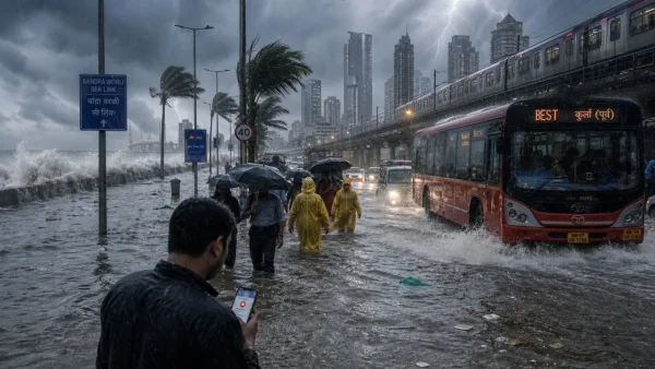
The monsoon in Mumbai has taken a turn. A week of unrelenting rain and the kind of disruptions that go with it have prompted the India Meteorological Department to put the city on its first red alert of the season. The forecast is for heavy to very heavy rain, with some isolated spots this weekend seeing wind gusts up to 60 kmph and the odd spell of extremely hard rain.
Why the red alert now
There has been no let-up in the downpour across several neighbourhoods. In as many as five days in a row, some parts of the metropolis have seen over 100 mm in a 24-hour period, and the bureau is calling for an intensification of the rain from Saturday on in the MMR.
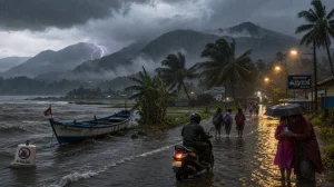
If you ask the meteorologists, they will point to a three-part setup: an off-shore trough, a shear zone above, and a low pressure system in the northeast Bay of Bengal that is set to become more pronounced in the next couple of days. Put them together and you get the kind of rain bands that are moving in on the Konkan and Mumbai.
This red alert is in place for Mumbai, Thane and Palghar from Saturday through Monday morning; for Raigad it runs until Sunday. To put the numbers in perspective, an orange alert means 115.6 to 204.4 mm in a day, but a red one is for when you are looking at anything over 204.4 mm.
Where the rain hit hardest
There was a respite of sorts by Friday afternoon, with the IMD’s observatories putting down just 18 mm from 8.30 am to 5.30 pm. But the evening brought a change of pace, and with it the usual late-day complications for those in transit.
The western side of town took the most of it in the 24 hours before Friday. According to the BMC, H West Ward Office had 150.6 mm, the Supari Tank school in Bandra 146 mm and Pali Chimbai 143.2 mm. On the east, N Ward was at 143 mm and Ramabai school in Ghatkopar at 136.4 mm.
You can add 134.2 mm at the Mankhurd Fire Station and 127.6 mm at the Collector Colony school in Chembur to the list. The island city had its share too: 141.8 mm at G South, 135.2 at F North, 120.8 at B Ward, 118.28 at Rawali Camp and 118 at N.M. Joshi Marg.
Looking at the window from 8 am Thursday to 6 am the next day, Mandavi was at 150 mm, Malabar Hill 145 and Fort 140. Andheri, Versova, Powai and Bhandup were in the 117 to 136 mm range. Santacruz and Colaba, per the IMD, were on the lower end at 51 and 37 mm respectively for the day.
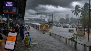
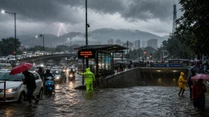
Some of the harder rain has left to waterlogging in places like Sion Gandhi Market and Dadra East, which has made for slow going. The civic side says public transport is running, but there have been reports of hold-ups on the suburban locals, adding to the day-to-day friction.
Water supply and high tides
One good thing to come of the wet weather is the state of the reservoirs. As of Friday, the seven lakes held 1.29 lakh million litres, or 8.93 per cent of what they can take. Tulsi and Vihar Lakes put in 164 and 137 mm between Thursday and Friday, which is a plus for early-season security.
Then there are the tides to consider. With the right amount of rain, they can make for more trouble. We are due for a high of 4.26 metres at 2.50 pm on Saturday and 3.60 at 2.52 am on Sunday. The lows will be 1.66 and 1.28 metres later in the day and the following morning.
Official guidance at a glance
What the weather bureau and the numbers say:
– Red alert for Mumbai, Thane, Palghar till Monday morning
– Raigad under red alert until Sunday morning
– Rain could top 204.4 mm in 24 hours
– An orange alert is for 115.6 to 204.4 mm in a day
– Some areas may see 60 kmph wind gusts
What comes next
According to the IMD, expect the heavy to extremely heavy rain to last in Mumbai through 5th July before things mellow out. Until then, with the way the tides and the weather are lining up, the risk of a flash flood is there, in the usual hotspots at any rate.
We have seen it all week: a quiet day giving way to a hard evening. With the trains and the streets already put to the test, the message from officials is to keep an eye on the advisories. The next few days will be a measure of how well the region is prepared for the monsoon and whether the new drainage holds up.