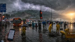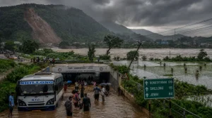
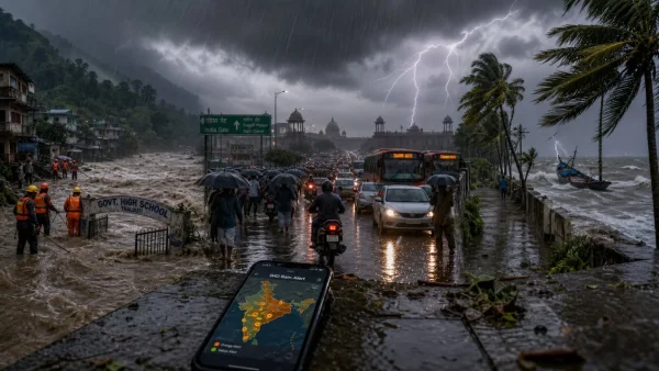
In what is shaping to be an intensification of the monsoon over India, the IMD has highlighted a growing risk of flash floods in the hilly states and is forecasting heavy to very heavy spells in a number of regions. While Delhi and other major metros prepare for a cloudy, rain-soaked period that will hold down temperatures and make for difficult travelling, the alerts extend to Uttarakhand, Assam and Kerala.
Flash flood risk rises as monsoon stays active
For the next 24 hours the IMD has identified a low to moderate flash flood risk in sections of Himachal Pradesh, Uttarakhand, Tamil Nadu and Kerala. In Himachal Pradesh this includes the vulnerable districts of Shimla and Sirmaur. For Uttarakhand, the list of exposed districts is long: Dehradun, Uttarkashi, Pauri Garhwal, Tehri Garhwal, Rudraprayag, Chamoli, Nainital and Pithoragarh.
Wayanad, Kozhikode, Malappuram, Palakkad, Thrissur, Ernakulam, Idukki and Kottayam are the Kerala districts under watch. In Tamil Nadu, localised flooding and inundation are risks in Coimbatore, Nilgiris, Dindigul and Theni, where surface run-off is expected.
Conditions in the Northeast are precarious. Official reports put the monsoon’s flood toll in Assam at 95, with fourteen districts on high alert. The IMD is still advising those in low-lying spots to exercise caution.
What is driving the rain this week
You can trace the current surge to a number of overlapping weather systems. Moisture is being anchored over the east and the heartland by a monsoon trough that runs from Firozpur, Rohtak, Lucknow, Daltonganj and Contai all the way to the northeast Bay of Bengal.
There is also a western disturbance hanging over northwest India. With upper air cyclonic circulations in evidence over parts of Uttar Pradesh, Bihar, Odisha, the Bay of Bengal and interior Karnataka, these combined forces will see to it that the north, east and northeast get their share of widespread rain.
The sea is no place to be right now. Rough conditions have prompted the IMD to tell fishermen to stay clear of certain stretches of the Arabian Sea and Bay of Bengal for the duration of the forecast.
Regional hotspots to watch
Jammu and Kashmir, Ladakh, Himachal Pradesh and Uttarakhand can expect fairly widespread to widespread rainfall through 12 August in the Himalayas. Rajasthan is likely to see activity build between 7 and 10 August while the monsoon trough is in effect.
Kerala is in for very heavy rain on August 6 and 7 in the south. An orange alert has been issued for Kasaragod, Kannur, Ernakulam, Idukki, Kottayam, Pathanamthitta and Alappuzha on the 6th, with the rest of the state on a yellow alert.
Tamil Nadu, Coastal Andhra Pradesh, Telangana and Karnataka are also likely to be hit hard, with thunderstorms and winds of 40 to 60 kmph in the mix. Rainfall will remain vigorous over the west coast and the Arabian Sea islands, including Lakshadweep and Coastal Karnataka, until August 11.
From August 6 to 11, Konkan and Goa are set for some fairly widespread rain. The 7th should bring heavy downpours and the 6th could see isolated very heavy rainfall. Gujarat may experience widespread activity from August 8 to 10.
Thursday, August 6 was a rainy start to the day in Delhi-NCR. Under a yellow alert, a cloudy sky and light to moderate rain are in the offing, keeping the mercury in check. One can expect a maximum of 31 to 33 degrees Celsius and a minimum of 22 to 24.
The city could be held below its seasonal average by moderate rainfall of 15.6 to 64.4 mm, according to the IMD. The week is set to be overcast. The IMD has put out its key warnings and timelines for easy reference:
– A low to moderate risk of flash flooding in the hills
– Very heavy rain for Kerala on 6 and 7 August
– Heavy rain in Konkan and Goa on the 7th
– Rain in Rajasthan to pick up between 7 and 10 August
Uttarakhand: Schools and safety
In Chamoli and Bageshwar, schools through Class 12 are shut following the heavy rain warnings. There has been no statewide holiday declared for Dehradun, Nainital or other districts, but District Magistrates have a habit of making on-the-day calls for Classes 1 to 12 and Anganwadis during monsoon season. It is best for parents and students to watch the official district channels for any last-minute closures dictated by conditions on the ground.
Authorities are keeping an eye on the Mandakini River in Rudraprayag given the unrelenting rainfall in the upper Himalayan catchments. The IMD forecast for 7 August 2026 calls for thunderstorms and lightning with some intense spells at isolated spots in Uttarakhand. In fact, their bulletin for 6 to 11 August indicates this kind of activity will be the order of the day through the 10th.
Outlook for the East, Central and West
Widespread rain is in store for the east, covering Odisha, Sikkim and both Gangetic and Sub-Himalayan West Bengal for the duration of the week. Bihar should see the same until 9 August, while Jharkhand could be hit with intense spells from 6 to 8 and then again from 10 to 12. The IMD has predicted isolated very heavy falls for Bihar and Odisha on the 6th and 9th respectively, and for Gangetic West Bengal on the 6th. Even after a July that saw 96 per cent excess, Odisha intends to scale back hydropower output in favour of irrigation and drinking water needs.
Central India will see fairly widespread to widespread rain in Madhya Pradesh from 7 to 9 August and in Chhattisgarh on the 7th and 11-12. East MP and Chhattisgarh are due for it from 6 to 8. West MP may have to contend with isolated very heavy rain on the 7th, and Chhattisgarh can expect thunder and lightning between 6 and 9.
To the northeast, Nagaland, Manipur, Mizoram and Tripura are all likely to get their share of rain from 6 to 11. Assam and Meghalaya will have fairly widespread rain on 6-8 and the 11th, with heavy amounts forecast. Arunachal Pradesh may see some heavy spells on the 7th and 10-11.
The west coast is no exception. Madhya Maharashtra is due for heavy rain on 6-7, as well as thunderstorms in Marathwada.
Looking at the past day, rainfall was intense. Figures from the last 24 hours show very heavy precipitation of 12 to 20 cm in places like east Rajasthan, Bihar, Lakshadweep and south interior Karnataka. Gangetic West Bengal, Delhi, Himachal Pradesh and others have reported 7-11 cm.
Given that active monsoons are expected to hold in many areas until 11 August and the northwest will see widespread rain through the 12th, the IMD is urging continued vigilance. Those in low-lying or flood-prone localities should be prepared for waterlogging, transport issues and the odd change in local advisories in the coming days.