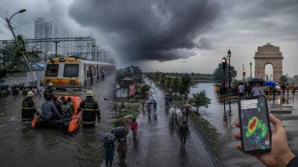
It was a hard weekend for much of the country. A strong monsoon push left Mumbai in the lurch, put a chill on Delhi and made for a damp week in Uttar Pradesh. The India Meteorological Department has put out word of more to come from a system in the Bay of Bengal that isn’t done with the rain yet.
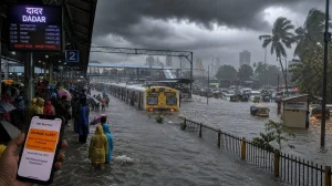
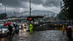
Mumbai reels as red alert triggers shutdowns
You can see the effect of the unrelenting downpour in and around Mumbai: clogged roads and local trains at a standstill. Once the IMD put a red alert in place, the BMC called off classes in schools and colleges, a sign of how bad things have gotten.
There have been some tree falls and other mishaps, too. In Palghar, a six-year-old was killed, and officials say they had to pull 180 or so people out of water-logged spots.
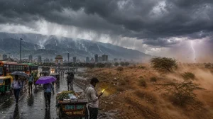
The west coast is not the only one with issues; Junagadh in Gujarat has been dealing with severe waterlogging. Some of Punjab has seen its share of heavy rain as well, all part of a general ratcheting up of the monsoon.
Why the rain is intensifying
The IMD puts it down to a low-pressure area in the northwest Bay of Bengal. It is set to be the driver of the monsoon in central India for the next few days, channelling moisture in and making for steady showers.
Over the course of the next four days, the agency says the southwest monsoon will make its way into what is left of Haryana, Punjab and Rajasthan, as well as bits of Gujarat and the North Arabian Sea. That should mean a wider area of rainfall in the northwest.
Isolated but very heavy rain is being watched for in Konkan, parts of Gujarat, Madhya Maharashtra, Saurashtra, Odisha and West MP. River basins and the coasts are on high alert for any quick changes in water levels.
Here is where things stand with the current alerts:
– Red in some of Maharashtra, Odisha, West Bengal and Kerala
– Yellow for Delhi on account of storms and wind
– An orange for Himachal on certain days
Delhi-NCR gets a breather, stays on alert
Some light to moderate rain has come through in Delhi, and with it a drop in the temperature and a break from the mugginess. The IMD is calling for this to hold until the 9th of July.
Safdarjung, the city’s main station, put in a top of 35.4 C, which is two degrees off the norm and a bit lower than Friday. Even with the yellow alert, the IMD is advising of some rough weather with lightning and gusts on the horizon.
Sunday saw a change in the air over the NCR, with Gurugram, Noida and Ghaziabad in for some moderate rain. If the hourly numbers are to be believed, there is a chance for some strong thunder in the afternoons and evenings.
Hills brace for a wet spell; northwest set to catch up
An orange has been put up by the Shimla Met office for the start of the week, with some places in for very heavy rain. Mandi and Sirmaur were in the crosshairs on Monday, Chamba, Kangra and Sirmaur on Tuesday.
The forecast is for this to last in Himachal till July 11. And as the monsoon moves on in the northwest, Haryana, Punjab and Rajasthan will be in for their fair share of it.
In Kerala, with river and dam levels on the rise, the call has gone out for flood and landslide precautions. The same Bay of Bengal system is due to pick up in Odisha and West Bengal, and with it, some rough seas and a lot of rain.
Uttar Pradesh: day-by-day outlook till July 11
Following some on-and-off rain, the Department is looking for a more concerted wet period in UP to cool things down. This applies to both the east and the west of the state.
To the east, some light rain is in the cards for the 5th to the 7th. Heavier stuff is likely from the 8th to the 11th, which should be a welcome change from the heat.
Western UP will have scattered rain from the 5th to the 8th. Then, as the monsoon firms up between the 9th and 11th, activity is expected to ramp up, with the odd area in for a drenching.
For those in the know, here are the windows for some trouble:
– Thunder and lightning in UP on the 5th
– From the 6th to the 8th, expect some of the same in both regions
How it all plays out is a matter of whether the low in the Bay of Bengal holds. For the time being, the IMD is pointing to another four or five days of it, with the worst of it in the west, the centre and some of the hills and the east.