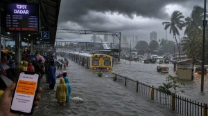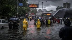

It was a wet start to the day for much of south Bengal and Kolkata on Tuesday morning. Waterlogging on underpasses and other key roads put a crimp in office-hour commutes. A well-marked low over Gangetic West Bengal is what the India Meteorological Department says is behind the spell; they anticipate another burst before things settle down in the city come Wednesday morning.
In a way, the downpour has been a stress test for urban mobility. Office-goers, school runs and the like have had to put up with it as traffic has been at a standstill in places or moving in fits and starts over several submerged stretches. The weather office said the system was all but stationary over the coastal belt this morning, which only added to the disruption.
Impact on mobility and services
There was no let-up as the day wore on. Rain picked up and low-lying areas were left to the water, slowing vehicles on the city’s major thoroughfares and those in adjoining districts. The snarls did not clear once rush hour was over.
One could say it is the persistence of the matter rather than any extreme that is defining the situation. The stagnant system has been feeding moisture into the metro and south Bengal, creating bottlenecks that last instead of short, sharp outbursts.
What the forecast signals next
The IMD is calling for heavy rain in parts of Gangetic West Bengal through to the morning of September 2, 2026. By then the low-pressure area covering the bay and north coastal Odisha should be making its way west-northwestward.
Caution is warranted along the coast. As the system moves inland and pressure gradients tighten, one can expect rough seas and squally winds of 45 kmph, a monsoon hazard of sorts.
North Bengal on alert till September 4
Predictions from the weather office are for heavy rain in the sub-Himalayan districts – Darjeeling, Kalimpong, Jalpaiguri, Alipurduar and Cooch Behar – to continue until the 4th. Kolkata, however, is not expected to see that level of rainfall for the week; the warning there is confined to the Wednesday morning period.
Numbers that define the downpour
The figures for the last 24 hours, up to 8.30 am on Tuesday, tell the story of how the rain has covered south Bengal:
– Kolkata: 23 mm in 24 hours till 8.30 am
– Panagarh: 50 mm in 24 hours till 8.30 am
– Salt Lake: 40 mm in 24 hours till 8.30 am
– Barrackpore: 43 mm in 24 hours till 8.30 am
– Haldia: 30 mm in 24 hours till 8.30 am
– Canning: 44 mm in 24 hours till 8.30 am
– Kalaikunda: 51 mm in 24 hours till 8.30 am
According to the IMD the rain has been building since Monday night with the low holding its ground. It is that kind of consistency, not isolated peaks, that has driven today’s problems.
How commuters can navigate disruptions
There is still a window of impact ahead, so some forethought will help sidestep the worst of it. Both the IMD and local authorities recommend being attuned to real-time conditions. A change in timing or route can save one from the choke points and waterlogged sections.
A few quick steps are in order before setting out:
– Make sure to check official weather and live traffic advisories
– Steer clear of peak hours if one can
– Take an alternative path around any flooded underpasses
– Leave non-essential trips for when the rain eases off
Put simply, it is a matter of tactics. The heaviest of it for Kolkata is front-loaded for Tuesday and early Wednesday, after which the risk moves north. For those in the city, the next 24 hours call for agility as the system turns west-northwest, not endurance.