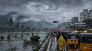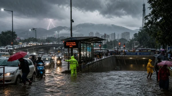
Bengaluru Weather Today, June 14th: As the monsoon picks up over Karnataka, the IMD has been warning of heavy downpours, storms and the possibility of floods. Some of the early rain has already made for a slow-moving commute with roads under water, so if you have to be out this weekend, you’ll want to plan for the odd spell of bad weather.
It was a cool 22 degrees or so by mid-morning, but you could feel the humidity as the clouds hung low. According to the IMD, the rain and lightning will be with us for a while, and in some parts of town the situation can change in a hurry as the monsoon builds in strength.
City impact in Bengaluru
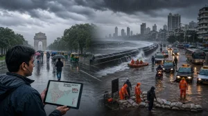
You can see the effect in the low-lying areas where there’s been some waterlogging and the usual rush hour congestion. If you’re on a two-wheeler, don’t head into flooded underpasses, and make sure to have an umbrella or a raincoat if you do go out.
Authorities are keeping a close tab on the more vulnerable neighbourhoods. With more rain in the offing, emergency teams are on high alert in the zones that have been hit.
Rain distribution: where it poured
If you look at the Varunamitra dashboard from the state’s disaster monitoring centre at 8.30 pm, you’ll see some localised deluges. Herohalli was the wettest at 37 mm, with Kengeri (24.5 mm), Hampinagar (20 mm) and Doddabodarakallu (18.5 mm) not far behind. A good eight wards had over 10 mm.
Then there were Saturday’s showers, which came on top of what we had from late Friday, making for some standing water overnight. Vansh, the South India Weatherman, was on the ground in west Bengaluru and put up a post about the misty, overcast morning and the 37mm he clocked, with some light rain to be had later on.
Statewide alerts and risks
Warnings have been put out for all of Karnataka – coastal, north interior, south interior, and our own city. The coast is in for some heavy rain and wind, and you can expect some stormy weather in the interior as well. They’ve also put a flag up on the danger of landslides in the Western Ghats and along the coast.
Timeline: what to expect next
Looking at the seven-day outlook for Bengaluru, the IMD is calling for a heavy day on Sunday and then something more like light to moderate for the rest of the week. We may be in for some of the same until the 15th, but things should start to let up after the 16th with no major red flags for a few days.
What residents should do now
The advice is to stay in when you can and follow the official line, since the weather can be fickle in some parts of the state. And if you are on the move, give yourself some leeway with time, particularly in the thick of it and near the usual bottlenecks.
Here is a run-down of the main points from the authorities:
– Don’t take your bike through a flooded road or underpass
– Have an umbrella or raincoat with you
– When the thunder and lightning get loud, stay inside
– Be on the lookout for any word of landslides in the coastal and Ghats areas
– Heed the IMD and any local traffic reports
The monsoon isn’t going to let up in Karnataka for a while, and some districts are in for a drenching. In Bengaluru, with the humidity and the repeated rain, it’s all about the flood-prone spots and getting home safely. So check in on the news, be a bit conservative with your plans and listen to the advisories for as long as this wet stretch goes on.