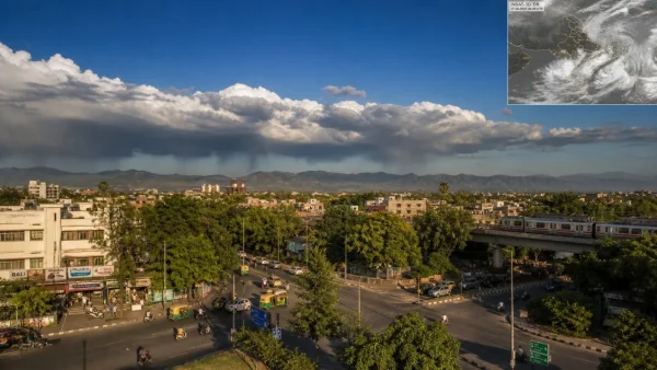
The abrupt pull-back of the monsoon from Delhi has sent the rain belt to the foothills, opening up a short dry window for Delhi-NCR as well as Punjab and Haryana. On-the-ground reports and satellite data show drier northwesterly winds have taken hold, cutting the humidity before any showers are likely to make an appearance around the 18th or 20th of the month.
In a way it is a tactical alteration to the season’s rhythm. The monsoon axis being closer to the hills means better comfort levels in the northwest even if the daytime heat does not break. City managers and those commuting will find fewer disruptions and more open skies for the next couple of days.
Monsoon axis pulls back; Delhi-NCR turns drier
Northwest India is seeing the dominance of dry northwesterly winds in excess of 10 kmph. According to weather analysts, this inflow of drier air will bring down the moisture content and relieve the stickiness of the past few days.
As the monsoon flow loses some of its moisture-laden strength, the real-feel temperature is set to ease. One can expect no major rainfall across Delhi-NCR, Punjab and Haryana through August 17, save for an isolated shower here and there in the evening.
Himalayan foothills and the east take the rain lead
The nudge of the monsoon axis towards the foothills has put parts of Himachal Pradesh, Uttarakhand and neighbouring areas in line for more rain. In doing so, the larger cloud mass is kept at bay from the northwest for the time being.
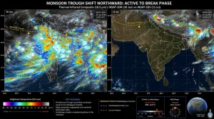
If one looks at the latest INSAT-3DS imagery from August 16, the bulk of the monsoon clouds are over central and eastern India. A band of them runs from eastern Uttar Pradesh into Bihar and the Bay of Bengal, while much of Punjab, Haryana and Delhi-NCR is left without cover.
Satellite evidence on August 16
What the imagery shows is a distinct divide in the north. The Indo-Gangetic east and the central belt remain active, but urban centres in the northwest are moving into sun breaks and a bit of a breeze.
Short-term outlook: dry now, watch Aug 18-20
Do not count on the dry spell to last. Models have the conditions shifting between August 18 and 20 when a low-pressure area from the Bay of Bengal comes inland to meet the monsoon trough.
Such an interaction has a way of pulling the axis south once more. Rainfall activity could well make a gradual comeback to northwest India as the week gives way to the weekend.
Over in the eastern half of the country, the system that is developing will see to it that heavy rain is concentrated in portions of Uttar Pradesh, Bihar, Jharkhand, Madhya Pradesh and the environs for the coming days.
Why this shift matters for the region
There is an immediate respite from the humidity in the afternoons, and with the thermometers holding their own, the lower moisture is welcome. Visibility is better too, so there are fewer weather-related delays to contend with.
It does pose a question of timing for planners though. Since the rain is due to return in the vicinity of August 18-20, being ready for another round of wet weather is essential.
Before finalising plans for the week ahead, these are the signals worth following:
– The dry northwesterlies are with us through the 17th
– A dip in humidity makes the real-feel less oppressive
– The hills are getting their share of the rain
– Keep an eye on the trough for a southward move by the 18th or 20th
What residents should expect
Across Delhi-NCR and the surrounding states of Punjab and Haryana, afternoons will be less muggy and more to the point. With the skies opening up and moisture ebbing, the evenings will be more agreeable.
Most places will stay dry but an odd shower in the evening is possible. Come midweek it is best to keep tabs on the updates as the Bay system and monsoon trough play out.
Put simply, it is a pause for now before a likely reboot. The window is open for Delhi and neighbours to have some clear skies, but the monsoon is far from finished with the area.