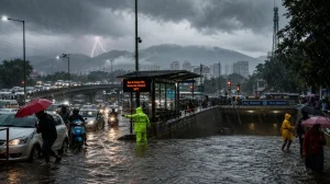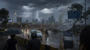
The kind of respite that has been hard to come by is in view for Maharashtra. According to the Meteorological Department, we should see the monsoon get going from June 18, with some new activity in the mix through July 2. The IMD is flagging off some rain and storms in the major hubs – Mumbai, Pune, Nagpur, and also Kolhapur, Satara, Sangli and Solapur. That bodes well for some cooler weather.
What changes after June 18
It’s not all at once. The numbers show a gradual build-up. South Konkan will get the first of it, but in Vidarbha the effect will be less pronounced until around June 25. From there on in, you can expect the system to put down roots and the intensity to ratchet up.
Assuming the forecast is on the money, the strain of the heat will let up in a number of districts. The department is of the opinion the monsoon will slowly get active all along the Konkan and then the rest of the state.
Why the monsoon stalled
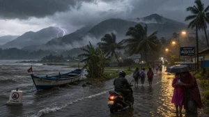
We saw the monsoon come in to lower Konkan on June 6 and make quick work of it up to Harne and Solapur. But for the last five days it has been in a holding pattern. The reason, officials say, is a change in the wind; some hot, dry northerlies have been in the way of the monsoon flow.
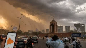
Then on June 13, 2026, the rain belt made a beeline for Hyderabad, coastal Odisha, and bits of West Bengal, Jharkhand and Bihar. We didn’t see much of that here in Maharashtra. Still, there have been the odd few scattered showers in some parts of the state.
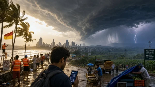
Alerts and local outlook
A yellow rain alert is out from the IMD for the whole of Konkan. Even so, you’ll find heatwave conditions in Palghar, Thane, Mumbai, Raigad and Ratnagiri, with some light rain to be had in the afternoon. Sindhudurg might get a little as the pre-monsoon clouds come in.
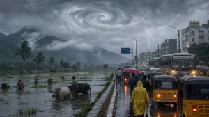
Kolhapur, Satara, Sangli and Solapur are under a yellow for rain and can look for some thunder. Pune is in for some light to moderate. Nashik and Ahilyanagar may see a light shower. Dhule, on the other hand, is likely to be left in the lurch, while Nandurbar and Jalgaon will be hot and muggy.
In Marathwada it’s a mixed bag. Chhatrapati Sambhajinagar and Jalna have a yellow heat alert. Parbhani and Hingoli are due for some, and Beed, Nanded, Latur and Dharashiv for a bit more.
Vidarbha has its own story. Amravati is looking at a heat wave. Bhandara, Chandrapur, Gadchiroli, Gondia, Nagpur, Wardha and Yavatmal could have some wind and thunder, and the heat is expected to make inroads in those areas too. Washim, Buldhana and Akola have no alerts at this point.
Immediate steps for residents
Given the way the alerts and rain are playing out, here is how to make life a little easier:
– Make a habit of checking the IMD for your district
– Work around the afternoon rain when you can
– Don’t be out and about in the thickest of the heat
– Put away anything that might blow in a gust
– Have your water and power backup in order
Coastal caution and travel advisories
Goa is being more of a stickler for beach safety as the monsoon comes into its own. Drishti Marine, the state’s lifesaving outfit, is telling people to stay out of the water. No swimming or water sports this time of year; the sea can turn on you in a hurry.
They have over 450 of their trained staff and marshals on 54 beaches – 30 in the south, 24 in the north – to help out. You will also find them at Mayem Lake, Dudhsagar, Savri and Mhovacho Guno.
What to watch next
After the 18th, the focus is on the rain line moving up from south Konkan. We will be looking for some action in the Konkan, a spread to central Maharashtra, and a definite shift in Vidarbha once we pass the 25th. Local alerts will ebb and flow as the monsoon gets back in gear.