When the rains and wind made their way through the region on 2 July 2026, it put an end to a stretch of unrelenting heat. The India Meteorological Department has fresh alerts to show for it, and they’re calling for a 4-5 degree dip in the high today with more to come as the southwest monsoon closes in on the capital.
On-ground change and early Thursday conditions
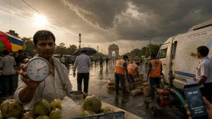
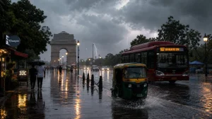
You could tell the difference when you got up this morning; there was some light to moderate rain in parts of town and a few dust storms before daybreak. The numbers back it up: at 6 am the IMD had us at about 28C, 83% humidity and a 14% chance of rain.
Some in Noida have been feeling the bluster. One from Sector 16 even put up a clip of the morning’s downpour. It’s a welcome turn of events after a week where the ‘feels like’ number was in the 50s.
Alerts, wind risk and the day’s forecast
We’re under a Yellow Alert for 1 and 2 July as the IMD has put a pin in the possibility of thunder, lightning and surface winds. You can figure on 30-40 kmph through the day, with those gusts spiking to 40-50 if a storm rolls in, under a good deal of cloud cover.
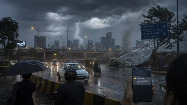
Then at 6:45 AM, the department put out a red warning for some of Delhi. They are on guard for a moderate thunderstorm with squally winds of 60-80 KMPH – and up to 100 in a lurch – and some solid rain over the next three hours. This one runs until 10:00 AM.
For 2 July, the top of the day is looking to be in the 32-34C range, with the low between 22 and 24. They say to be on your toes for some thunder and lightning in the afternoon and evening.
Monsoon timing: what to expect and why it matters
If the IMD is right, the monsoon will be in our neck of the woods by 3 or 4 July. That would be the latest it’s been in five years. In the next 48 hours, the setup is right for it to move in over the north Arabian Sea and a host of states from Gujarat to Haryana and up to Chandigarh.
If you look at the satellite, you’ll see the clouds and activity piling up in the north. We’ve already seen a 1-2 degree let-up in the last 24 hours thanks to some pre-monsoon rain and westerly winds in the 15-20 kmph bracket.
How onset is declared in Delhi
It’s not just a hunch; the IMD needs to see widespread, steady rain for two days in a row at stations like Safdarjung before they put a name to it. You also need the easterlies from the Bay of Bengal to come in with the moisture, and for the cloud bands to hold.
Heat breaks, but rainfall outlook stays cautious
There’s a good chance of some wet weather for the next four or five days, but don’t get too comfortable. The IMD is saying July as a whole might come in under normal, with totals below 94 per cent of what we’re used to. North India has had a late start to the monsoon and a 40 per cent shortfall in June to make up for.
Just this week, Safdarjung hit 40.5 with a 31.2 low. The Ridge was 41.5 and Ayanagar 40.1. You had hot, dry air from Pakistan meeting in with the southwesterlies from the sea, which made for some cloud but not a lot of rain.
With the storms picking up today, the agency is forecasting a 5-7C drop in the highs and 3-5 in the lows over the next couple of days. Intermittent spells like these will make for a more pleasant day, even if the month looks a bit thin on paper.
What to watch in the next 48 hours
A few things to keep an eye on as the monsoon makes its way in:
– Yellow Alert in effect for 2 July on rain and storms
– Squally winds in the 60-80 KMPH range, with 100 possible
– 30-40 kmph gusts, 40-50 in a thunderstorm
– 2 July to see 33C and 23C
– Monsoon should be here 3 or 4 July
The road ahead
Expect the skies to stay up and the odd shower and bolt of lightning for the next few days. The IMD has the pieces in place for the monsoon to move into Delhi and beyond, but they won’t make the call until the books are in order for two full days.
Today is a break from the heat. But the real question is whether the monsoon that’s coming can put June’s deficit in the past and put an end to the kind of long, hard summer we’ve had since May.