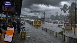
From June 18, Hyderabad and most of the state are in for a wet, tempestuous few days. The yellow alert means there will be some strong winds and, for once, a break from the heat. Whether you’re a farmer, in business or just heading to work, plan for the weather to get in the way.
IMD alert and the week ahead
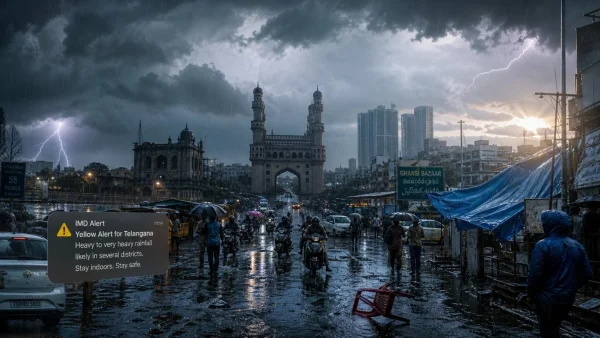
Telangana is under a yellow alert for rain that could be widespread through Sunday, June 21. What we have now in the way of scattered storms is expected to give way to something more substantial as the week wears on, with the heaviest of it coming between the 18th and 21st.
You’ll see some lightning and squally weather up to June 17, but as the monsoon picks up, the rain will come in harder bands. The IMD is on record saying the north and east of the state will be the most active spots for this.
T. Balaji, who keeps a close eye on the weather, puts it like this: Hyderabad is in for some showers over the next couple of days, but it gets much better after the 18th. He also points to the possibility of some serious thunder in northern and eastern Telangana.
Hyderabad outlook: unstable now, heavier rain next
Until the 17th, the forecast for the city is light to moderate rain, maybe a thundershower with some wind. There’s a lot of moisture in the air making for unsteady conditions, but expect the downpours to set in after June 18.
It’s a good idea to keep an eye on the official numbers and build in some extra time for your commute. Intermittent rain and lightning can put a crimp in your day and make for rough roads.
Districts on watch
The IMD says to be ready for heavy rain in parts of Hyderabad, Rangareddy and Medchal-Malkajgiri. The same goes for Vikarabad, Sangareddy, Mahbubnagar, Nagarkurnool, Wanaparthy, Narayanpet and Jogulamba Gadwal as the system builds.
In the Adilabad, Komaram Bheem Asifabad, Mancherial, Jayashankar Bhupalpally, Mulugu and Bhadradri Kothagudem districts, isolated pockets of thunder and wind are in the cards for the 15th to the 17th.
Wind and thunderstorm risks
Winds of 30-40 kmph are possible in some places until the 17th. But from the 18th to the 21st, they could top 40-50 kmph in spots. That means a higher chance of a tree coming down, some waterlogging or a short power outage.
Then there’s the lightning. When the clouds are up, don’t be in an open field or by anything tall. The authorities are clear on that one.
Heat now, respite later
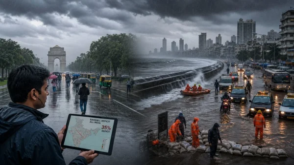
We’ve had our share of rain in some corners, but the mercury is still high. TGDPS figures show Peddapalli was the hottest at 42.5C on Sunday. In Nampally, it was 37.7C – a reminder of what we’re in for before the monsoon really moves in.
Don’t expect much of a change on the 15th or 16th. But once we hit the 17th, the temperature should drop 2 or 3 degrees as the rain comes in.
What residents should do this week
Rain, wind and lightning are all in the mix. A few easy things can help you avoid trouble:
– Have a look at the IMD before you head out
– Don’t stand under a tree if there’s lightning about
– Put away anything outside that might blow in the wind
– Make sure your phone is charged in case the power goes
– Know where the water tends to pool on your route
The word from the top is to heed local warnings, particularly when the storms are at their peak. If you live in a low spot, check on the drainage and move your car to higher ground if the forecast calls for a deluge.
In short, it’s a period of change for the state: some early storms, a bit of a downpour midweek and then a slight cooling off. With the yellow alert running until the 21st, being prepared is the only way to go.