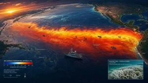
Scientists are putting out warnings about what is shaping up to be a once-in-a-generation climate jolt in the Pacific. A developing Super El Nino is on course to peak in November or December 2026 and become the strongest in living memory, driving a pronounced increase in worldwide temperatures and making for more hazardous weather in the near term.
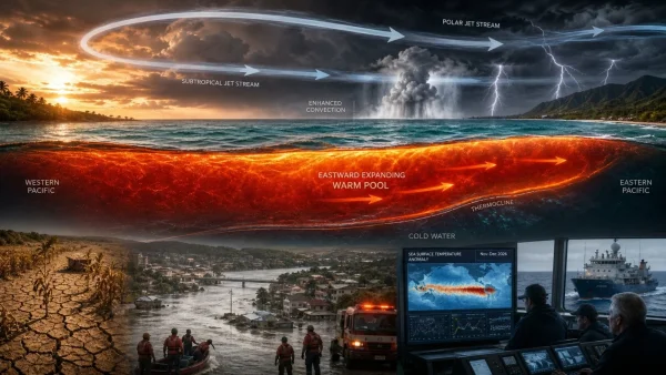
According to climate analysts, sea surface readings in the equatorial Pacific have already crossed into Super El Nino territory. But what has researchers concerned is the volume of heat banked below the ocean; their models put it at levels higher than those of 1982-83, 1997-98 or 2015-16.
Colin McCarthy noted the event is setting new records in terms of stored heat under the Pacific, the rate of warming and the projected intensity of its peak. Should that energy make its way to the surface in the coming months, the trajectory will only steepen.
Why this Super El Nino is alarming
The heat accumulating in the tropical Pacific is no distant problem. It is an energy source waiting to be released, capable of surfacing to supercharge the atmosphere and hasten warming over a wide expanse of ocean.
Such a change has a way of throwing circulation patterns out of kilter around the world. The ripple effects can be felt well beyond the Pacific in the form of altered rainfall, droughts, heatwaves and flood risks.
A peak window with global stakes
We can expect further strengthening from scientists’ point of view in the latter half of 2026, with the maximum impact arriving in the final two months of the year. Forecasts suggest it may leave previous benchmark events in the dust.
Then there is the matter of human-driven, long-term warming. Researchers put forward that global averages could edge close to 2 degrees Celsius above pre-industrial figures in early 2027. By the assessments put forward, that would put the planet in a state of affairs not seen for hundreds of thousands of years.
What to expect in the next 12 to 18 months
Meteorologists say we are entering a time of greater climate volatility. One need not look at the regional specifics to see the broad signal: extremes are more probable and they may come in quick order.
Experts monitoring the El Nino have these as the priority risks:
– Heatwaves of greater frequency and intensity
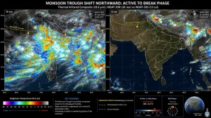
– A change in how and when the monsoons come
– Drought in certain areas
– Flood hazards in others
It is hard to be precise so far in advance and impacts will differ from place to place. Still, all eyes are on the unusually large reservoir of subsurface heat as a potential fuel for the event if it comes to the fore.
Implications for India and monsoon-reliant regions
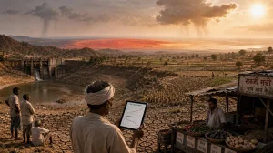
In India and other parts of the world reliant on the monsoon, the issue is not simply a matter of more or less seasonal rain. It is the distribution and timing of it that will determine water security and whether crops make it.
One cannot judge the outcome by the El Nino’s strength alone, scientists caution. Other oceanic and atmospheric variables will have their say in how the season plays out. A clearer picture of the consequences will emerge in the November-December period.
What scientists are watching now
Analysts are looking at the pace at which the subsurface heat rises, any eastward spread of the warm pool and if surface anomalies hold or stall. These are the tell-tale signs of how the atmosphere will react.
Researchers describe the next few months as a possible dramatic test of the Earth’s climate system. Provided the forecasts are right, the El Nino will gain in force through the end of 2026 and modern records may have to be re-written.
Readiness in the face of uncertainty
While the exact map of what is to come is unclear, the warning signs are plain. As the risk window opens, it will be down to good water management, heat planning and being ready for floods.
For authorities and businesses alike, the November-December peak is a decision point. There is little time to act, so the focus should be on preparing for some weather whiplash rather than trying to get precision from long-range regional forecasts.