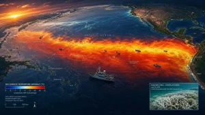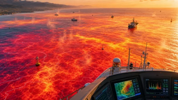
In short, these record-hot waters and a building El Nino are set to ratchet up the intensity of bad weather and strain on our environment. There have been some record sea surface temperatures in June, and the World Meteorological Organization has its eye on an El Nino that is likely to get stronger from July through September. That means more to worry about in the way of cyclones, flooding and the like. If you look at the numbers, average sea surface temps in the world’s tropical and temperate oceans are sitting just shy of 21C for the month of June – a first. Put that against the 19.6C norm before the days of heavy industry in 1870 and it does not seem like a lot. But it is a figure that belies the amount of energy being put into the climate system by the oceans.
For the most part, the oceans, not the air, have taken in over 90 per cent of the extra heat from greenhouse gases. To put it in perspective, researchers have calculated that in 2025 the seas will have soaked up as much heat as 12 Hiroshima-type atomic bombs going off every second for the year. You have to go back some 120,000 years to see this kind of warmth in the water. Back then, it was a slow process driven by natural orbital changes. What we have now is a human-made change that has put the oceans in the same position in a little over 100 years, making for rougher conditions on land.
El Nino is only making it worse. We are already seeing sea surface temperatures in the central and eastern Pacific run more than a degree above where they should be. In some spots, the anomaly is 1.24C, and down below the surface in the eastern Pacific it is over 6C out of the ordinary.
The WMO is calling for those key Pacific areas to top 2C above average in the coming months. “This will intensify the chances of drought and heavy rainfall and increase the risk of heatwaves on land and in the sea in many parts of the world,” says WMO Secretary-General Celeste Saulo.
There is a lag to how El Nino makes itself felt, which is why 2027 may well be hotter than 2026. As the heat the ocean has in reserve makes its way back into the atmosphere, it will stoke up global temperatures and the kind of weather extremes we have come to expect.
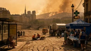
Europe is a case in point. The Mediterranean is running as much as 6C over the long-term average, with the North Sea some 3C warmer. You end up with an ocean that puts more humidity in the air and makes for heavier rain and more heat on the ground nearby.
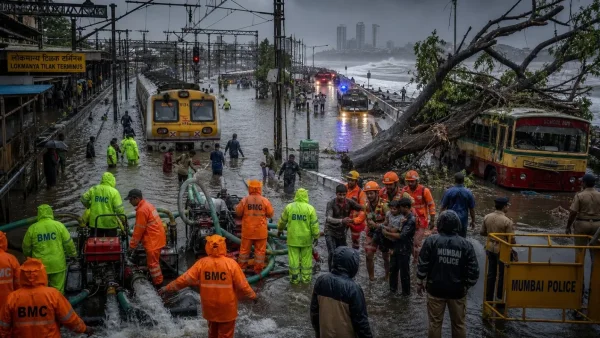
Take the marine heatwave in the North Atlantic in June 2023: it was no coincidence that Europe had to deal with some of the harshest heat in recent memory. Spain was hit hard by floods, and there were wildfires in several Mediterranean nations. With El Nino and the oceans on the rise, we could be in for more of the same, scientists say.
Then there is the toll on the sea itself. Marine heatwaves are no good for coral or the seagrass and coastal habitats that the fishing and tourism industries rely on. A hot spell on land is over in a few days, but in the water it can go on for months, and not every species can keep up.
Why hotter oceans supercharge weather
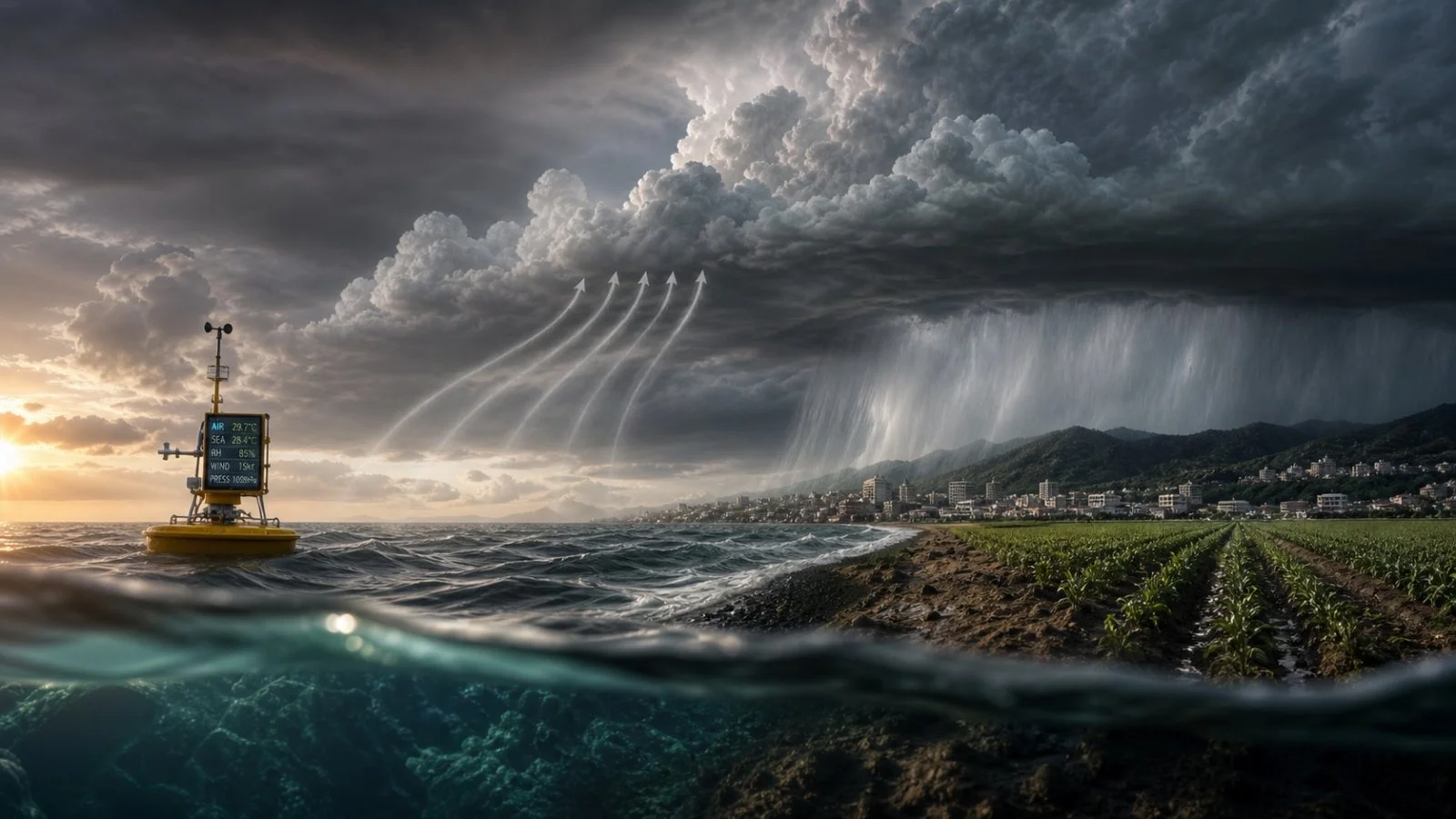
Think of the oceans as a vast battery. They are the planet’s main heat sink, which keeps air temperatures from spiking right away, but that energy has to go somewhere. As one put it, “The heat stored in the oceans doesn’t simply remain there.” Eventually, it is used to make weather.
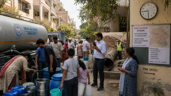
When the sea is warm, you get more evaporation and the air can carry more of it. Storms then have that extra to work with, resulting in cloudbursts and flash flooding. On the flip side, when the rain does not come, you are left with a longer dry period and more water stress.
Summer heat also lingers over cities and fields because the water is not as effective at cooling things down. And for a tropical cyclone, warm water is an opportunity to build up and let loose with some serious rain once it comes ashore.
El Nino’s global footprint in the months ahead
What we are in for is a round of marine heatwaves in the western Indian Ocean, the tropical Atlantic and the eastern Pacific, along with a nudge in global temperatures. It is not like a storm that is in and out; El Nino is usually with us for nine to 12 months, and the worst of it is often to come.
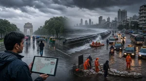
In the past, this has meant less rain for some of Australia, Indonesia and Southeast Asia, while the west of South America has to contend with the opposite: unseasonable downpours and the flooding that follows. Some areas in the east and south of Africa could be in for less rain than usual, which means a higher chance of drought and trouble with food supplies. The WMO’s most recent outlook has it that we will see sub-normal rainfall in portions of the Indian subcontinent, a good deal of Australia and here and there in the tropical Indian Ocean. On the flip side, the central and eastern equatorial Pacific and the Gulf of Guinea are set for above-average precipitation. South America is to have some wetter days, while the Greater Horn of Africa, Central America and bits of the Caribbean are more likely to be on the dry side.
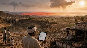
India is upping its game on preparedness
June was a case in point: India started the monsoon with a 40 per cent shortfall in rain, and sowing had to be done in a tighter window. When you add it up by the end of the month, the total sown area came to 182 lakh hectares – a 23 per cent drop from this time last year. Oilseeds have been hit the hardest. In Chhattisgarh, they have not waited to put a plan in place for the 2026 kharif. The agriculture department is putting the word out to farmers to make use of short and medium-duration crops, conserve water and be ready for a monsoon that is late to show or leaves early. What is being put in front of the farmer: – Go with shorter or medium-term varieties – Make do with less water in the fields – Have a plan for a monsoon that drags its feet or an early exit – Be set for long dry stretches in between – Put the IMD’s Sachet, Damini and Meghdoot apps to work There is a move toward Direct Seeded Rice; it can cut down on irrigation by 20 per cent, save close to Rs 5,000 an acre and get the harvest in a couple of weeks sooner. In the uplands where rain is thin, the advice is to look at pigeon pea, green gram, black gram, soybean, sesame or groundnut. To build some resilience against the kind of rainfall you can’t count on, officials are also calling for row sowing, proper seed treatment and a balanced hand with fertiliser. Chief Minister Vishnu Deo Sai has told his departments to have district-level plans in order, see to the irrigation and make sure seeds and technical help are on hand when the kharif season is in full swing.
The toll on the oceans
The 2023-24 El Nino and the unusual heat of 2024 have left their mark on a number of ocean basins. You see it in the spread of coral bleaching, in marine life moving on to find something cooler, and in the way fisheries are being thrown off as the warming rewrites the rules for food chains and migration. We have been seeing more of these marine heatwaves in the last few decades, and they are tending to be longer and harder. They are not like what happens on land; they can go on for months, and a lot of species are not built to keep up. That is a risk to both biodiversity and the livelihoods of those who depend on the sea. It does not stay in the water. The way the ocean holds and gives off heat has an effect on the weather, storms and rain thousands of kilometres out. It is now a factor in how we handle seasonal risks for farming and disaster response on several continents.
Better at predicting, but we have to watch our backs
There is some positive to be had. In places like the U.S. and Australia, the last two years have seen a marked step up in the quality of three- to four-month forecasts for marine heatwaves. It gives the authorities a head start before an ecosystem is in trouble. With that kind of notice, an agency can ease up on fishing, put a protective ring around a sensitive habitat or put a conservation measure in motion. The same is true for the man in the field or the water planner: better seasonal data means less of a guess when it comes to a coming flood or cyclone. But scientists are quick to point out that all of this hinges on having the data. There have been some concerns in the U.S. over moves to pull back on the money for ocean and monitoring programmes. If you don’t have the observations, the forecast is only as good as it seems. You need to be able to put together the picture of the atmosphere, the anomalies and the sea to run the models for El Nino or a tropical storm. If that system is underfunded, governments will be left to react with very little to go on. El Nino is part of nature, but the overall warming has made it a more hazardous proposition. The high temperatures we are recording are the sum of human activity and another cycle of El Nino, one risk on top of another. In the end, you can only do so much with adaptation. As one report put it, ‘The only way to prevent climate change from steadily worsening is to reach net zero as soon as possible.’ A good forecast may give you a moment, but it is the cutting of emissions that cools things down.